Serviços de Agrimensura e Consultoria

Regularização fundiária e medição de terras com precisão.

Consultoria Especializada

Esclarecemos suas dúvidas sobre regularização de imóveis.

Levantamentos com GPS, estação total e drone.

Serviços de obras e saneamento básico eficientes.

Medição de Terras
Obras e Projetos

(89) 99461-7966

Sobre Nós - AL Topografia

Na Al Topografia, oferecemos serviços de agrimensura e consultoria, garantindo a regularização de imóveis urbanos e rurais com tecnologia de ponta, como GPS GNSS e drones desde 2012.

Lote incravado
Lote incravado

12 anos

Sem Restrição

Clientes Satisfeitos

Experiência Comprovada

Serviços de Agrimensura

Oferecemos consultoria e serviços de regularização fundiária para imóveis urbanos e rurais.

Consultoria em Regularização

Ajudamos a sanar dúvidas sobre regularização de imóveis e documentação necessária.

Medição de Terras

Realizamos medições precisas com GPS GNSS e estação total para sua propriedade.

Levantamentos Aéreos

Utilizamos drones para levantamentos aéreos, garantindo eficiência e precisão em nossos serviços.
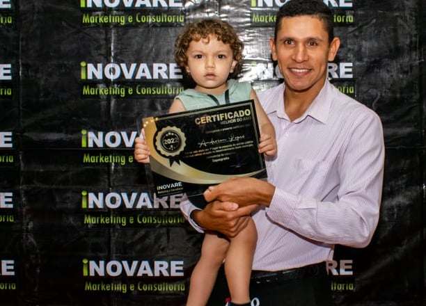
Agrimensor do ano

Projetos em Andamento

Serviços de agrimensura e consultoria para regularização de imóveis.

A person wearing a reflective safety vest stands outdoors on grassy terrain. They are holding equipment and seem engaged in some form of land survey work. Nearby, a tripod with a white circular device is set up, casting a shadow on the ground.
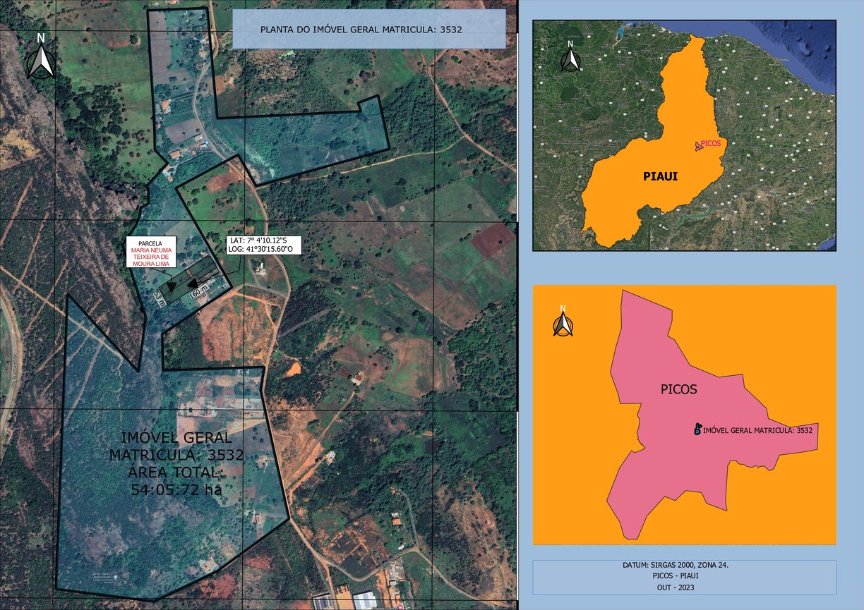
Levantamentos Topográficos

Utilizamos GPS, estação total e drones para precisão.

A surveying instrument mounted on a tall pole stands in the foreground, with a bright blue sky and scattered clouds above. In the background, there are several modern high-rise buildings, indicating an urban area.
Consultoria Especializada

Esclarecemos dúvidas sobre regularização de imóveis urbanos e rurais.

Three men are working on a green field; one is operating a theodolite on a tripod, while the other two are kneeling on the grass, marking or measuring points. In the background, a small airplane is parked in front of a hangar, which has bold numbers painted on its roof. The sky is partly cloudy, and there is a tall communications or weather tower near the hangar.
A close-up of a surveying instrument, specifically a total station, mounted on a tripod. The instrument features an orange cylindrical target with a reflective surface and a black and yellow square backing with a cross pattern. The background is blurred, showing some cars and trees, suggesting an outdoor setting.
Medição de Terras

Realizamos medições precisas para projetos de infraestrutura e obras.

Obras e Projetos

Desenvolvemos serviços para estradas, saneamento e linhas de transmissão.

Galeria de Projetos

Confira nossos serviços de agrimensura e regularização fundiária.

Architectural or urban planning layout with labeled sections and codes. It includes detailed dimensions, various structural elements, streets, and plot numbers. There are also annotations and technical notes.
A person wearing a white hard hat and high-visibility vest operates a surveying instrument, focusing intently on the task at hand. The background is blurred with hints of other construction activities or team members.
A construction scene featuring a bright orange survey tripod in the foreground, with a blurred yellow bulldozer moving dirt in the background. The scene has green trees and shrubs on the left side and some buildings partially visible on the right side under a clear blue sky.
A woman wearing a red safety helmet and yellow earmuffs operates a surveying instrument mounted on a tripod. She is standing in a construction area with a compact excavator in the background. Her casual attire includes a white eyelet blouse and blue jeans, and she is holding a digital level.